🌟 Exclusive Amazon Black Friday Deals 2024 🌟

Don’t miss out on the best deals of the season! Shop now 🎁

Anyone have a map of a continent at home for habitat knowledge?

elephantnose3334

Fishaholic
Joined
May 9, 2023
Messages
626
Reaction score
381
Location
Perth, Australia
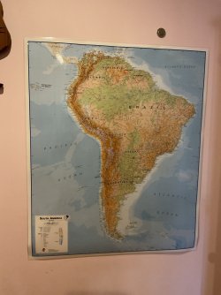
I got a laminated physical map of South America for my birthday from grandparents 9 days ago, despite it arrived late rather than in Dec 20. It's almost 10 years old and Maps International haven't updated yet, but I like it. I might use it for knowledge of rivers that are in the continent. It may sound silly, but do you have a physical map of a continent for habitat knowledge?
 

Attachments

  • IMG_0860.jpg
    IMG_0860.jpg
    251.2 KB · Views: 21
I have a very large world map that takes up one wall of my office. There are 5 working clocks above the map and a model plane I built suspended from the ceiling.
IMG_3094.jpeg
 
I used to have maps of Australia, plus each state, and various maps of areas in the states, mainly in WA, NSW and Qld. I also had maps of New Guinea. I used the maps to look for waterways to collect fish from.
 
I used to have maps of Australia, plus each state, and various maps of areas in the states, mainly in WA, NSW and Qld. I also had maps of New Guinea. I used the maps to look for waterways to collect fish from.
Have you ever collected from the Torres Strait Islands?
 
I had maps of Cameroon and Gabon, a road map about 20 years old. It was in excellent detail.

I now use google earth, and have a lot of placemarks with info as I try to put it together in my head. I find it interesting to see how how evolution has worked with geology.

I also had local maps that allowed me to stand back and look at how details merged into each other, for small fish fishing. They went by the wayside as I stopped looking for Canadian fish.

The human side of maps change - placenames, country names, borders and boundaries. The geology takes a lot longer, so what matters in a map is very stable.
 
I have some very simple internet pictures of Africa and the Americas showing all the different river systems in different colours. What I would love is detailed maps showing the pHs of rivers as different colours, with hardness / tds info for each. This info is available for all rivers that have been collected from. It’s just not collated in one place.
 

Most reactions

Back
Top